


Florida Braces for Hurricane Ian
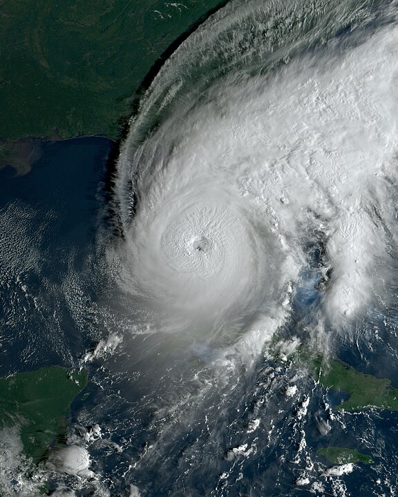
Photo of Hurricane Ian approching Florida.
September 27, 2022
All hands on deck this morning as Floridians rush to make last minute preparations for Hurricane Ian, according to the National Weather Service Ian is expected to make landfall in Florida early Wednesday morning at 2AM eastern daylight time unleashing a torrential downpour on the Florida keys before making its assault on the Tampa Bay area where it will be at its full, category three strength. Battering the coastal city with sustained winds of up to 125 MPH and storm surge approaching fifteen feet. In response to the impending disaster the city of Tampa has issued mandatory evacuation orders for the city’s residents who live in the predicted surge zones that can extend up to two miles inland.
Closer to home in central Florida, Seminole county has issued a state of emergency. Sandbag distributions have been organized across the county, mobile home residents and those who live close to lakes and rivers are recommended to evacuate to appointed emergency shelters. A flood watch has been issued in the central Florida region by the National Weather Service and the National Oceanic and Atmospheric Administration. Sustained winds of up to 60 MPH are to be expected throughout the week.
Please refer to your local governments website for more information.